
|
U. S. CIVIL WAR
PHOTOGRAPHS
|

|
JEB STUART'S RIDE
AROUND MCCLELLAN
(PAGE 8 of 11)
| |
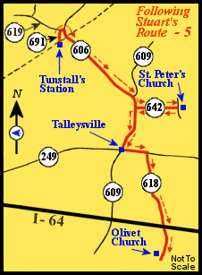
Route
(in red)
from Tunstall's Station, upper
left, to St. Peter's Church, Talleysville, and the
Olivet Church, lower right.
Following the Route Numbers:
Using Route 642 we return to Route 609 and turn left.
After a mile we arrive at the intersection of Route 609 and Route 249.
This is Talleysville.
|
... The roads at this point were far worse
than ours, and the artillery had much difficulty in passing. Our march
was finally continued by bright moonlight to Talleysville, where we
halted 3 1/2 hours for the column to close up. At this point we passed a
large hospital of 150 patients. I deemed it proper not to molest the
surgeons and attendants in charge ...
 (T) (T)
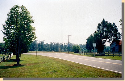
Talleysville.
Where Stuart's troops rested the night of June 13, 1862. (You are looking
East on Route 249. Route 609 is crossing in front of you.)
Following the Route Numbers:
We turn left from Route 609 onto Route 249, New Kent Highway.
About a one-half mile down Route 249, we turn right onto Route 618,
Olivet Church Road.
A mile and one-half past where Route 618 crosses over Interstate 64, we come
to Olivet Church on the right.
|
 (U) (U)
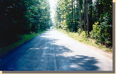
Road to Olivet Church.
 (V) (V)
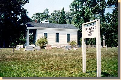
Olivet Church.
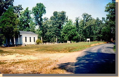 (V) (V)
Olivet Church.
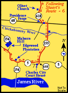
Route
(in red)
from Olivet Church, upper center,
to the Malvern Hill Battlefield, middle left.
Following the Route Numbers:
Continuing down Route 618, we make a left turn onto Route 60 at Providence
Forge.
Almost immediately we make a right turn onto Route 155.
About three-fourths of a mile down Route 155 we come to two bridges crossing
branches of the Chickahominy River
|
...At 12 o’clock at night the march was continued without incident
under the most favorable auspices to Forge Bridge (8 miles), over
the Chickahominy, where we arrived just at daylight. Lee, of the
Ninth, by personal experiment having found the stream not fordable,
axes were sent for and every means taken to overcome the difficulties
by improvised bridges and swimming. I immediately dispatched to
you information of my situation and asked for the diversion already
referred to. The progress in crossing was very slow at the point chosen,
just above Forge Bridge, and learning that at the bridge proper enough
of the debris of the old bridge remained to facilitate the construction of
another, material for which was afforded by a large warehouse
adjacent, I moved to that point at once. Lieut. Redmond Burke, who in
every sphere has rendered most valuable service and deserves the
highest consideration at the hands of the Government, set to work with
a party to construct the bridge. A foot-bridge was soon improvised,
and the horses were crossed over as rapidly as possible by swimming.
Burke's work proceeded like magic; in three hours it was ready to bear
artillery and cavalry, and as half of the latter had not yet crossed, the
bridge enabled the whole to reach the other bank by 1 p. m. Another
branch of the Chickahominy still farther on was with some difficulty
forded, and the march was continued without interruption toward
Richmond ...
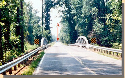 (W) (W)
Route 155 crossing the Chickahominy River (two channels).
The arrow points to the second bridge.
|
|
PAGE NINE
 >
Civil War Photos
>
Stuart's Ride
>
2
>
3
>
4
>
5
>
6
>
7
>
8
>
9
>
10
>
11
>
Civil War Photos
>
Stuart's Ride
>
2
>
3
>
4
>
5
>
6
>
7
>
8
>
9
>
10
>
11
|
|


