USA Civil War Website

USA Civil War Website
Discover The Civil War

Site Notifications
Home » U. S. Civil War Photographs - Petersburg
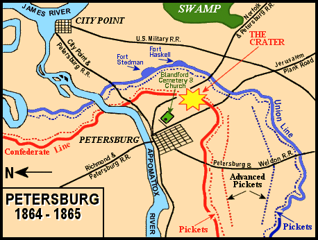
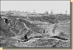

Union Flag Carrier U. S. CIVIL WAR
PHOTOGRAPHS
Confederate Flag Carrier

PETERSBURG
(PAGE 1 OF 5)

Location

OUR VISIT TO PETERSBURG

In the text, the is a link to the definition of the word it marks.
Use your browser's "back" button to return to this page.


Petersburg Map
Siege Lines around Petersburg. Note that "North" is to the left.
(After a Library of Congress map by Dr. J. B. Stinson, 1908.)


THE CRATER

The Crater - 1865 19
The Crater, as it appeared in 1865.
The Crater
The Crater - January, 1998.

  The grass covered mounds (enclosed by a wooden fence in the photo above) are all that remain in 1998 of the results of the massive 1864 explosion.

Petersburg Mine Map


Crater - 2006
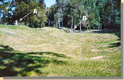
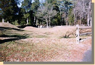
The Crater, A different View - 2006.
A - Mahone Monument (view blocked by trees).
B - South Carolina Monument.
See Page Two


Confederate Countermine location
Confederate Countermine Location - 2006.
Countermine sign
Sign describing the countermine - 2006.


PAGE TWO


Home > Civil War Photos > Petersburg > Page 2 > 3 > 4 > 5

Notes


Copyright © USA Civil War.com, 1998 - 2024.