
|
U. S. CIVIL WAR
PHOTOGRAPHS
|

|
NORTH ANNA
(PAGE 1 OF 3)
In the text, the icon  is a link to the definition of the word it marks. is a link to the definition of the word it marks.
Use your browser's "back" button to return to this page.
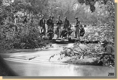
The North Anna River - Pontoon bridge - May 1864
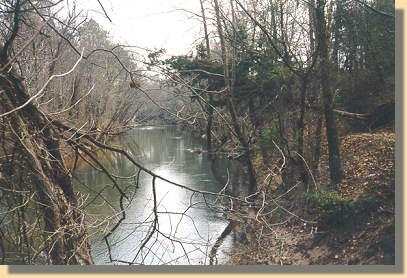
The North Anna River - 1999
| |
Other Names: Telegraph Road Bridge, Jericho Mill (May 23);
Ox Ford, Quarles Mill, Hanover Junction (May 24)
May 23-26, 1864
Estimated Casualties: 4,000 total
After the fighting at Spotsylvania Court House, Grant continued
his Overland Offensive against Lee's Army of Northern Virginia. He
was brought up short on the North Anna River by Lee's widely
studied �hog snout line,� which forced Grant to divide his army
into three parts in order to attack.
On May 23, 1864, one of A.P. Hill's divisions assaulted the V Corps which had crossed the river at Jericho
Mill, resulting in bloody see-saw fighting. On the 24th, Union infantry was
repulsed at Ox Ford (the snout) but advanced to near the Doswell House on
the Confederate right. Lee hoped to strike an offensive blow, but he was ill,
and the opportunity for defeating an isolated part of the Federal army passed.
Once the threat of Lee's position was revealed, Grant withdrew both wings of
the army back across the North Anna River. Grant outflanked the position by moving downstream and
continued his advance on Richmond.
(Text Source: U.S. Gov't, National Park Service)
There is a South Anna River. Lee refers to the two as the "Annas".
|
|
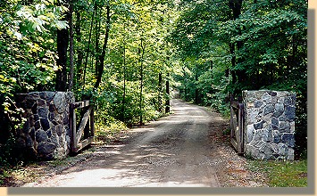
Entrance to the Park.
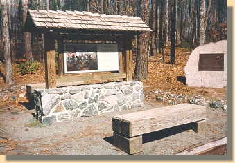
Entrance From Parking Lot
Note the Plaque on the Stone to the right.
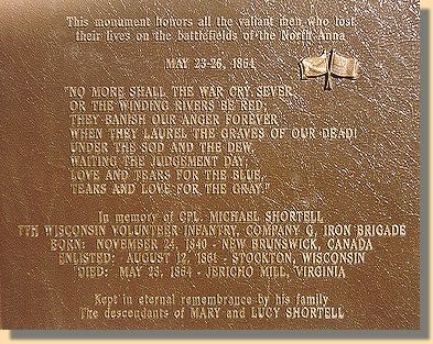
North Anna Plaque
Click
HERE to read the text.
PAGE TWO
 >
Civil War Photos
> North Anna
>
Civil War Photos
> North Anna
Notes
|
|
