|
U. S. CIVIL WAR
PHOTOGRAPHS
|

|
SPOTSYLVANIA COURT HOUSE
(PAGE 2 OF 8)
MULE SHOE SALIENT (BLOODY ANGLE)
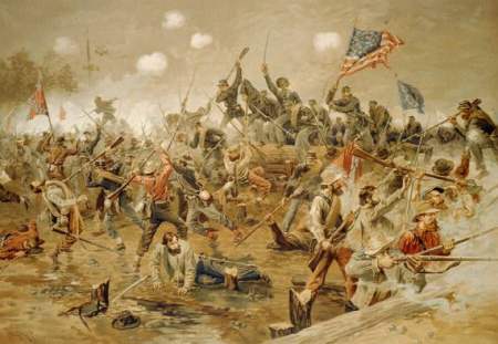
Battle of Spotsylvania.
Chromolithograph.
| |
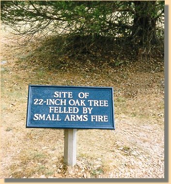
It was at the Bloody Angle [ (1) on the map below ], which is a part of the
Confederate "Mule Shoe Salient ", that the Federals initiated the most famous
action at Spotsylvania on May 12th. For 20 hours, the soldiers struggled in
hand-to-hand combat through mud and gore across this bend in the Confederate
lines. ", that the Federals initiated the most famous
action at Spotsylvania on May 12th. For 20 hours, the soldiers struggled in
hand-to-hand combat through mud and gore across this bend in the Confederate
lines.
|
|
| |
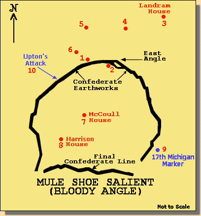
The Confederate works at the Mule Shoe
Salient including the Bloody Angle(1).
This map is roughly based upon the National Park Service's "Spotsylvania History
Trail" brochure. The numbered dots on the map indicate locations where the
photographs on this site were taken. Using the numbers ( ) at each
photograph, or group of photographs, and referring back to the map, you may have
a better understanding of the battlefield.
|
|
|
|
|
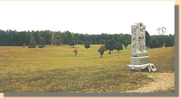
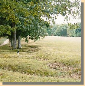
Confederate view (1) from the Bloody Angle.
|
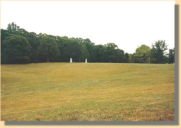
Union View (4) towards the Bloody Angle.
|
(1)
Confederate Line looking West from the East Angle.(2)
PAGE THREE
 >
Civil War Photos
>
Spotsylvania
>
Page 2
>
3
>
4
>
5
>
6
>
7
>
8
>
Civil War Photos
>
Spotsylvania
>
Page 2
>
3
>
4
>
5
>
6
>
7
>
8
Notes
|
|