
|
U. S. CIVIL WAR
PHOTOGRAPHS
|

|
SHARPSBURG (ANTIETAM)
(PAGE 9 OF 13)
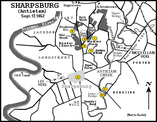
Location of Photographs.
Letters in parentheses( ) at the photographs refer to this map.
Click on any letter on the map to see a representative photograph.
222
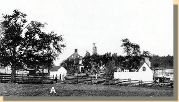
Burned Mumma Farmstead - 1862(C)
|
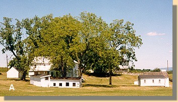 Reconstructed Mumma Farmstead - 1998
|
The Mumma Farmstead was the only civilian property destroyed during the battle.
Burned by the Confederates to prevent its use by sharpshooters, it
was rebuilt the next year.
(If the buildings marked "A" in the above photographs are the same, a
relationship between the 1862 and 1998 photographs can be made.)
|
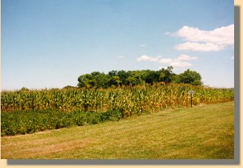
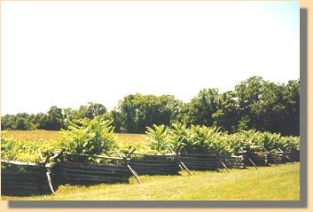
Cornfield and the Remains of the East Woods (D)
Northern Face of the West Woods (E)
|
|
|
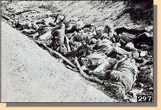
The "Sunken Road" at Antietam - 1862. (F)
|
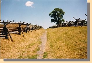
The "Sunken Road" at Antietam - 1998. (F)
|
PAGE TEN
 >
Civil War Photos
>
Sharpsburg
>
Page 2
>
3
>
4
>
5
>
6
>
7
>
8
>
9
>
10
>
11
>
12
>
13
>
Civil War Photos
>
Sharpsburg
>
Page 2
>
3
>
4
>
5
>
6
>
7
>
8
>
9
>
10
>
11
>
12
>
13
Notes
|
|
