USA Civil War Website

USA Civil War Website
Discover The Civil War

Site Notifications
Home » U. S. Civil War Photographs - Fredericksburg Page 3


Union Flag Carrier U. S. CIVIL WAR
PHOTOGRAPHS
Confederate Flag Carrier

FREDERICKSBURG
(PAGE 3 OF 8)


MARYE'S HEIGHTS & THE SUNKEN ROAD

Sunken Road Map
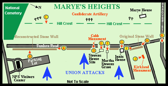
Map of Marye's Heights and the Sunken Road.
(The circled letters indicate where and in what direction the photographs were taken.)
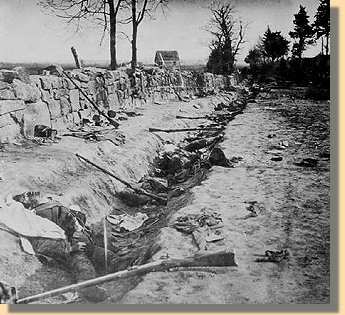
Sunken Road & stone wall 1863 23 Stone wall 2005
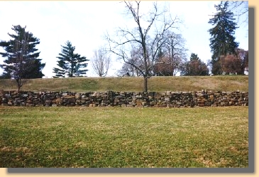
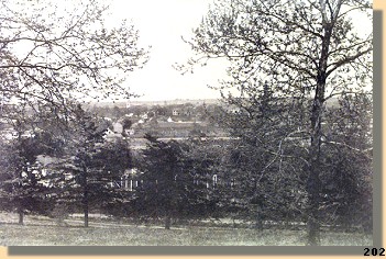
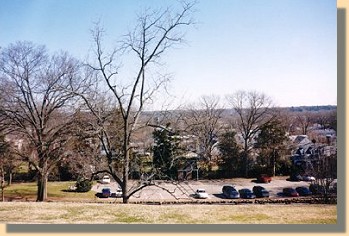
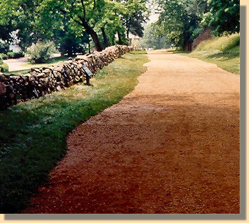
1863 & 2005 photographs of the sunken road and stone wall.   (A)
 
The Confederates used the stone wall along the sunken road below Marye's Heights to repeatedly drive back Union attacks in December, 1862. The photograph on the left, showing dead Confederate soldiers, was taken after the Union overran a weaker Confederate force holding the position while the majority of Lee's forces were at Chancellorsville in 1863. The 2005 photograph shows the reconstructed portion of the wall.


Wall & Marye's Heights
1998 Union view of the stone wall, with Marye's Heights in the background.   (B)


View from Marye's Heights - 1860s   View from Marye's Heights - 1998
1860s (left) & 1998 (right) photographs of Fredericksburg from Marye's Heights.   (C)


In the 1998 photograph (on the right), the National Park Service Visitors Center Parking Lot is located below the Stone Wall in the foreground. (Note the Stone Wall/Sunken Road at the bottom of Marye's Heights in the foreground of each photograph).


FREDERICKSBURG - PAGE 4


Home > Civil War Photos > Fredericksburg > Page 2 > 3 > 4 > 5 > 6 > 7 > 8

Notes


Copyright © USA Civil War.com, 1998 - 2024.