
|
U. S. CIVIL WAR
PHOTOGRAPHS
|

|
CHANCELLORSVILLE
(PAGE 5 OF 8)
| |
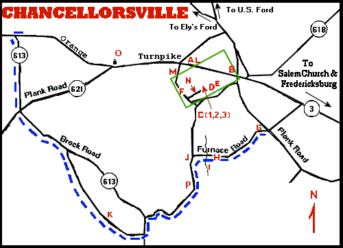
Chancellorsville Map
Described on Page 1.
(The green rectangle outlines the map below.)
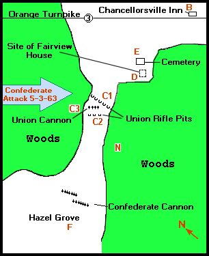
A closer view of the Hazel Grove - Chancellorsville Inn area.
The letters in parentheses ( ), below, refer to locations on this map.
A very brief description of the events at the locations indicated
on this map:
- Early on the morning of May 3, 1863, Hooker, adjusting his
lines, moved the Union Cannon from Hazel Grove to near the
Fairview house.
- J.E.B. Stuart, commanding Jackson's forces, immediately
occupied Hazel Grove with more cannon than he had room to place
there. Lee arrived, consolidating the two wings of his army which
had been divided during Jackson's flanking move.
- Confederate sharpshooters, cannon fire, and troops attacking
from the Northwest, forced the Union troops to abandon Fairview and
relocate to around the Chancellorsville Inn.
- Confederate attacks, with support from cannon at Fairview,
forced Hooker to withdraw from the Chancellorsville Inn area to
the Rappahannock River near United States Ford.
- After the battle of Salem Church, between Chancellorsville and
Fredericksburg, Hooker moved his forces across the Rappahannock
River, thus concluding the battle of Chancellorsville.
|
|
HAZEL GROVE
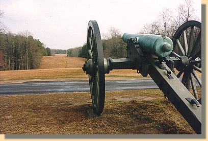 (F)
(F)
1999 view from Hazel Grove towards
Fairview and the Chancellorsville Inn.
|
|
|
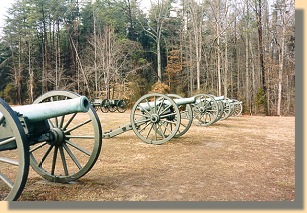
Confederate Guns at Hazel Grove
(F)
|
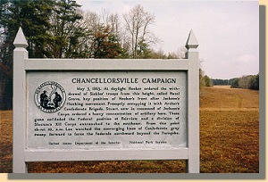
National Park Service Sign
at Hazel Grove
(Click on the photo to read the text).
|
PAGE SIX
 >
Civil War Photos
>
Chancellorsville
>
Page 2
>
3
>
4
>
5
>
6
>
7
>
8
>
Civil War Photos
>
Chancellorsville
>
Page 2
>
3
>
4
>
5
>
6
>
7
>
8
|
|
