|
U. S. CIVIL WAR
PHOTOGRAPHS
|

|
CEDAR MOUNTAIN

(PAGE 1 OF 3)
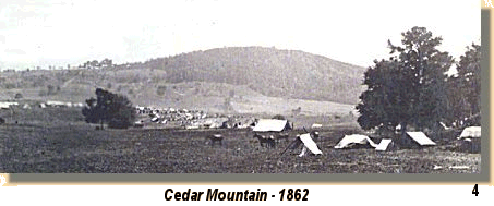
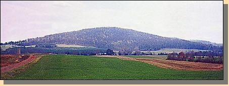
Cedar Mountain - 2000
(A)
OUR VISIT TO CEDAR MOUNTAIN
In the text, the icon  is a link to the definition of the word it marks.
Use your browser's "back"
button to return to this page.
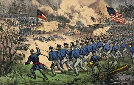
The battle at Cedar Mountain, Aug. 9th, 1862.
Charge of Crawford's Brigade on the right.
Published by Currier & Ives, between 1862 and 1872
Cedar Mountain Battlefield
Troop and Road Positions are Approximate.
|
|
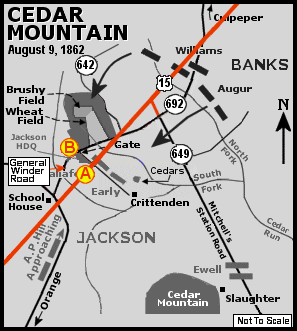
Current Roads and Locations of Photographs
Current roads are numbered. New roads are marked in red. Locations of the
photographs, not the direction of the photographs, are marked with circled red
letters. The corresponding letter at each of the photographs in this section
refers to this map.
|
| |
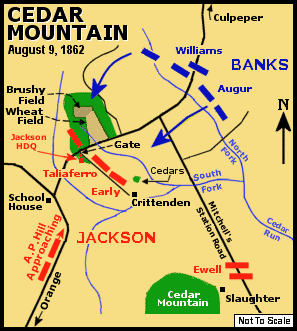
August 9, 1862
Estimated Casualties: 2,707 total
(US 1,400; CS 1,307)
In 1862, after Union troops were driven away from the Confederate capital in the
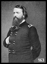
Seven Days battles, the Lincoln Administration turned to Major General
John Pope. Pope forged an army out of the several
Union commands defeated by Stonewall Jackson in the Valley and christened the
new fighting force the Army of Virginia.
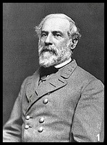
Concerned by Pope's move to Culpeper Court House and his proclamations against
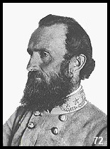
Southern civilians, Robert E. Lee quickly dispatched Stonewall Jackson
to Gordonsville with the order: "I want Pope to be suppressed."
|
|
|
|
|
John Pope
|
Robert E. Lee
|
"Stonewall" Jackson
|
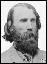
A. P. Hill
|
Outnumbered by Pope's forces, Jackson looked for an opportunity to strike.
Pope unwittingly divided his army along the Rapidan River. Jackson then advanced
hoping to isolate a portion of Pope's army near Culpeper.
Although he had been reinforced by Major General A.P. Hill's large "Light
Division," Jackson was
hampered by poor roads and problematic orders.
 Jackson vented his frustrations on A.P. Hill, sparking the most celebrated
feud in the history of Lee's lieutenants.
Jackson vented his frustrations on A.P. Hill, sparking the most celebrated
feud in the history of Lee's lieutenants.
Pressing forward towards Culpeper on August 9, 1862, Jackson's troops
encountered Union cavalry blocking the
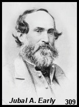
road near Cedar Run. Confederate Brigadier General Jubal A. Early formed a
line of infantry and artillery perpendicular to
the road with the right of the Southern line anchored on the shoulder of Cedar
(or Slaughter's) Mountain.
|
|
CEDAR MOUNTAIN - PAGE 2
 >
Civil War Photos
> Cedar Mountain
>
Page 2
>
3
>
Civil War Photos
> Cedar Mountain
>
Page 2
>
3
Notes
|
|