
|
U. S. CIVIL WAR
PHOTOGRAPHS
|

|
TODD'S TAVERN
(PAGE 1 OF 5)

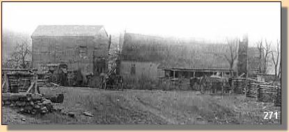
Todd's Tavern at Junction of Brock, Catharpin and Piney Branch Roads.
In the text, the icon  is a link to the definition of the word it marks.
Use your browser's "back" button to return to this page.
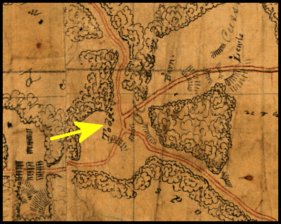
1862 Map of Spotsylvania County, Virginia, 223
showing Todd's Tavern (Arrow).
| |
On May 4, 1864, Lieutenant General Ulysses S. Grant led Major General George G.
Meade's Union Army of the Potomac
across the Rapidan River into the tangles of
the Wilderness. Robert E. Lee attacked him there, and in two days of heavy
fighting Grant had both flanks turned and took more than 17,000
casualties. Rather
than retreat, he issued orders on May 7 for a night march to Spotsylvania Court
House, the next stop on the road to Richmond. To get there, his cavalry would
first have to clear Confederate cavalry from the Brock Road. This would lead to
some of the most intense and important cavalry fighting of war around a country
crossroads called Todd's Tavern.
|
|
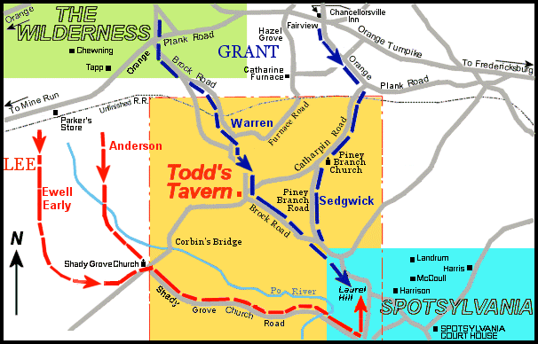 Movement of the Union and Confederate Armys from the Wilderness to Spotsylvania.
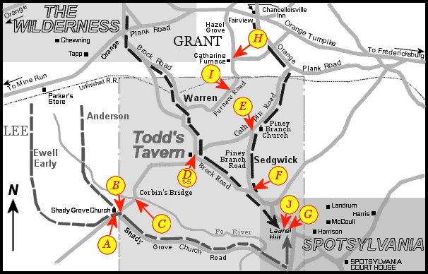 Location of Photographs in this Section
The letters in parenthesis, i.e. (B), in the following text refer back to this map.
(Click on a letter on this map to see a representative photograph.)
PAGE TWO
 >
Civil War Photos
>
Todds Tavern
>
2
>
3
>
4
>
5
>
Civil War Photos
>
Todds Tavern
>
2
>
3
>
4
>
5
Notes
