 |
U. S. CIVIL WAR
PHOTOGRAPHS
|
 |
MINE RUN
(PAGE 1 OF 2)
 In the text, the icon
  is a link to the definition of the word it marks. is a link to the definition of the word it marks.
Use your
browser's "back" button to return to the page.
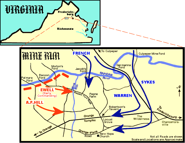
Mine Run - Troop Movements.
| |
November 27-December 2, 1863
Estimated Casualties:
1,952 total (US 1,272; CS 680)
2,465 total (US 1,653; CS 812)
|
Source - National Park Service
Source - Battles & Leaders of the Civil War
|
After the July, 1863, Battle of Gettysburg, Confederate General Robert E. Lee's
Army of Northern
Virginia and Union Major
General George G. Meade's Army of the Potomac returned to
Virginia soil establishing lines on opposite sides of the
Rapidan River in northern Virginia. From this location a series of battles were
fought, ending with the Mine Run Campaign in
November/December.
In November, Meade learned that several fords across the Rapidan River
(including Jacobs, Germanna, and Culpeper Mine) which were located on Lee's
right flank, were unguarded.
Accordingly, he decided to use the fords to cross the Rapidan and attack the
Confederates from the rear.
His attack, scheduled for November 24th, was delayed for forty-eight hours
due to heavy rains. It was during this delay that a Confederate scout reported
to Lee that the Union army was intending to move.
On November 26th the Union army, using the aforementioned fords, crossed the
Rapidan River and proceeded down the Orange turnpike, and other roads, toward
the rear of Lee's lines. They hoped to reach Robertson's Tavern at Locust Grove
that day, but the muddy roads, caused by the previous rains, slowed their travel
and they halted far short of the tavern. At the same time, Lee began shifting
his army east to block the Union army's flanking move.
November 27th thru 29th Positions
Daybreak on the 27th found both sides moving toward each other. Skirmishing
began about 11 a.m. near Robertson's Tavern (Locust Grove) between the
Confederate divisions of Major
Generals Jubal A. Early and Robert E. Rodes,
and Major General Gouvernor K. Warren's Union Second Corps (See  , above). The fighting
continued throughout the day, as both sides awaited the arrival of reinforcements.
Meanwhile, three miles to the south, Brigadier General David M. Gregg's Federal
cavalry clashed with
Major General J.E.B. Stuart's Confederate horsemen near New
Hope Church on the Plank Road. , above). The fighting
continued throughout the day, as both sides awaited the arrival of reinforcements.
Meanwhile, three miles to the south, Brigadier General David M. Gregg's Federal
cavalry clashed with
Major General J.E.B. Stuart's Confederate horsemen near New
Hope Church on the Plank Road.
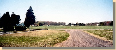
View from in front of the modern New Hope Church

|
The access road (foreground) to the New Hope Church
comes from the Orange Plank Road, Route 621 (background),
which crosses in front of the Church in the distance.
|
Both sides fought a holding action until about 2:30 p.m. when Major General
Henry Heth's Confederate division occupied the key high ground west of the
church. A short time later the men of Major General George Sykes's Union Fifth
Corps arrived and pushed Heth's division off the hill, occupying it themselves.
Meade ordered Sykes to hold his position until the entire army was ready to
attack.
Father to the north, Major General William French's Union Third Corps, in an
effort to unite with Warren's corps at Robertson's Tavern, advanced
slowly up Woodville Road from Jacob's Ford to the crossroads at the Widow
Morris farm.
|
|
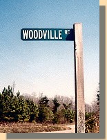
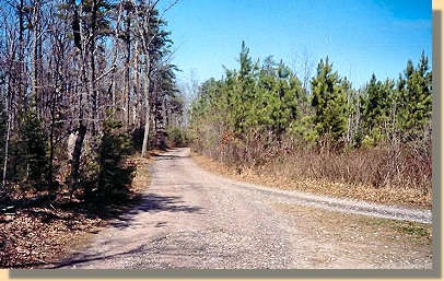
Woodville Road looking towards Jacob's Ford.

French's Corps came down this road (toward the camera).
|
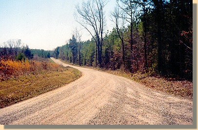
A continuation of the Woodville Road
toward the the Widow Morris Farm
The right fork led directly to the tavern after merging with Raccoon Ford Road,
(modern State Route 611) which was partially blocked by Confederate cavalry. It
also led to the exposed left flank of Rodes division. The left fork also led to
the tavern, but by a much longer route. French lost valuable time pondering
which road to follow.
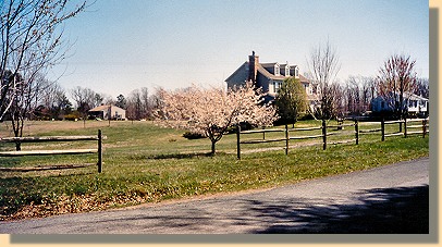
Widow Morris Farm

|
Generals French and Prince wasted several hours at this location debating
which road to take. During the fighting at Payne's Farm, French used the
Widow Morris house as his headquarters. A modern structure now stands on
the site of the Morris house, at the southeast corner of the road junction.
|
|
|
PAGE TWO
 >
Civil War Photos
>
Mine Run
>
Page 2
>
Civil War Photos
>
Mine Run
>
Page 2
|
|
