
|
U. S. CIVIL WAR
PHOTOGRAPHS
|

|
MALVERN HILL
(PAGE 4 OF 4)
Malvern Hill
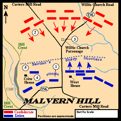
The circled numbers on this map indicate the locations
from which the photographs in this section were taken and
refer to the numbers in parentheses ( ) at the photographs.
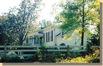
The Crew House - 2002.(5)
| |
The Crew House -- also known during the war as Dr. McBert's -- is a key landmark
of the battlefield. In 1862, numerous outbuildings were located close to the
house, and a small orchard stood nearby. The original house burned in the 1870's,
and this structure stands on the foundations of the wartime building.
Federal artillery located in the
yard anchored the left of the Union line. located in the
yard anchored the left of the Union line.
|
|
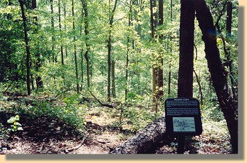
The Malvern Cliffs - 2002.(5)
| |
The NPS Sign reads:
"The view from here illustrates the power of the Union position on Malvern Hill.
Late in the afternoon of July 1, two Confederate Brigades attacked across the
treeless flat terrain below. Union guns in the Crew yard and elsewhere pounded
the Confederate line before the Southern infantrymen could open fire with
muskets.
"Still, the Confederates reached the base of the hill, where they would cling
to the safety of the slope. Finally at dusk Virginians and North Carolinians
rushed this knob, eventually reaching the yard of the Crew house. Only
frantic resistance by the 14th New York infantry and several pieces of Union
artillery halted them. Here as elsewhere, Confederate efforts to destroy
McClellan's army had failed."
|
|
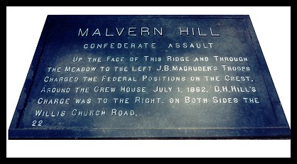
Freeman Marker at the Crew House.(5)
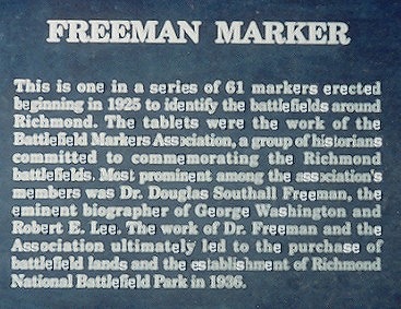
N.P.S. description of Freeman's Markers.(5)
 >
Civil War Photos
>
Richmond - Outlying
>
Malvern Hill
>
Page 2
>
3
>
4
>
Civil War Photos
>
Richmond - Outlying
>
Malvern Hill
>
Page 2
>
3
>
4

|
|
