
|
U. S. CIVIL WAR
PHOTOGRAPHS
|

|
KELLY'S FORD
Battle Fought March 17, 1863

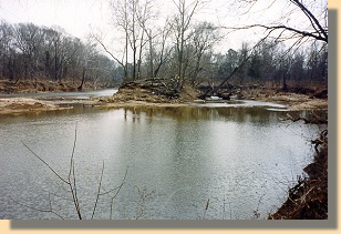 Approximate location of Kelly's
Ford on the Rappahannock River.
(A)
In the text, the icon  is a link to the definition of the word it marks. is a link to the definition of the word it marks.
Use
your browser's "back" button to return to this page.
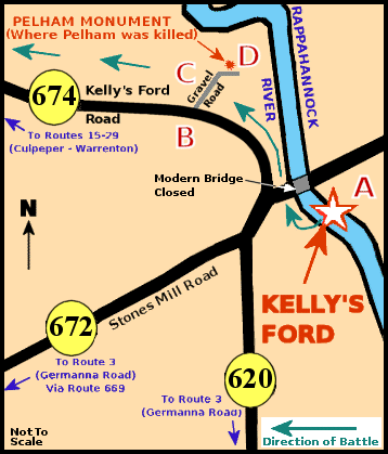 Kelly's Ford Area Map.
|
The Kelly's Ford of 1863 (star on the map) crossed the Rappahannock River
downstream from the present bridge (Which was closed at the time of this
writing). The letters on the map indicate where the photographs on this page
were taken.
|
| |
March 17, 1863
Estimated Casualties: 200 total
Kelly's Ford was one of the early larger scale cavalry fights in
Virginia that set the stage for Brandy Station and cavalry actions of the
Gettysburg campaign. Twenty-one hundred troopers of Averell's cavalry division crossed the
Rappahannock River to attack the Confederate cavalry. Fitzhugh Lee
counterattacked with a
brigade of about 800 men.
The "Gallant" Pelham was killed. (See my
John Pelham page.)
After achieving a localized success, Union forces withdrew in mid-afternoon.
(Text Source: U.S. Gov't, National Park
Service)
|
|
|
|
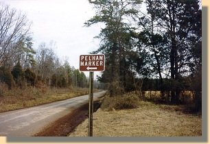
Road side sign indicating the
location of Pelham's Marker.
(B)
|
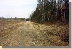
A long walk down a road in the woods.
(C)
During the course of the battle, Union troops were to the right of this road
and Confederate troops were to the left. (See the
green
arrows on the map, above.)
|
|
|
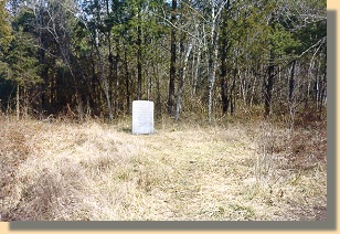
Cut into a forest, this monument marks where Pelham was
mortally wounded.
(D)
|
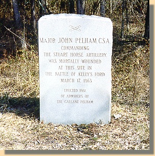
MAJ JOHN PELHAM C.S.A.
COMMANDING
THE STUART HORSE ARTILLERY
WAS MORTALLY WOUNDED
AT THIS SITE IN
THE BATTLE OF KELLY'S FORD
MARCH 17, 1863
ERECTED 1981
BY ADMIRERS OF
THE GALLANT PELHAM
|
|
 >
Civil War Photos
>
Kelly's Ford
>
Civil War Photos
>
Kelly's Ford
|
|
