
|
U. S. CIVIL WAR
PHOTOGRAPHS
|

|
GLENDALE (FRAYSER'S FARM)
In the text, the icon  is a link to the definition of the word it marks.
Use your browser's "back"
button to return to the page.
| |
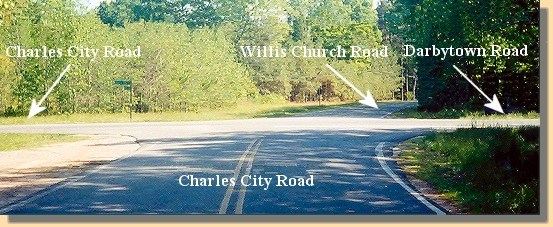
Glendale; the Riddell's Shop Intersection (Facing South).
Frayser's Farm is in the distance to the right of
Willis Church Road.
The roads at the Riddell's Shop Intersection are identified in this photograph.
The Willis Church road (also known as the Quaker Road) originates at this
intersection and goes south, passing Frayser's Farm, the National Park Service
Visitor's center, the Willis Church, the remains of the Willis Church parsonage
and, eventually, Malvern Hill.
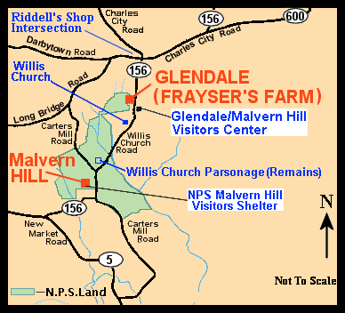
Glendale and Malvern Hill Map.
The locations identified in blue can be seen either here or on the
Malvern Hill pages.
June 30, 1862
Estimated Casualties: 6,500 total
This is the fifth of the Seven Days's Battles. On June 30, Huger's, Longstreet's,
and A.P. Hill's divisions converged on the
retreating Union army in the vicinity
of Glendale or Frayser's Farm. Longstreet's and Hill's attacks penetrated the
Union defense near Willis Church, routing McCall's division. McCall was captured.
Union counterattacks by Hooker's and
Kearny's divisions sealed the break and saved their line of retreat along the
Willis Church Road. Huger's advance was stopped on the Charles City Road.
"Stonewall" Jackson's divisions were delayed by Franklin at
White Oak Swamp. Confederate Maj. Gen. T.H. Holmes
made a feeble attempt to turn the Union left flank at Turkey Bridge but was driven back by Federal
gunboats in James River. Union generals Meade and Sumner and
Confederate generals Anderson, Pender, and Featherston were wounded. This was
Lee's best chance to cut off the Union army from the James River. That night,
McClellan established a strong position on
Malvern Hill.
(Text Source: U.S. Gov't, National Park Service)
|
|
|
|
|
1999
|
2005
|
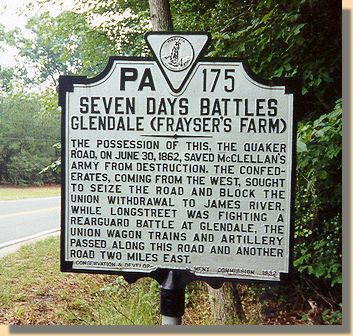
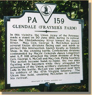
State marker at the Riddell's Shop intersection.
(Marker on the left was recently replaced by the one of the right.)
Click
Here
to read the text of the markers.
|
| |
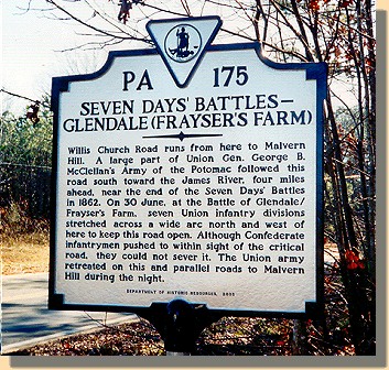
A second State marker at Riddell's Shop intersection.
(Across the street from the one above)
Click
Here
to read the text
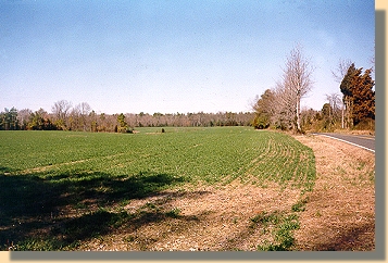
A View of Frayser's Farm at Glendale.
Looking north along the Willis Church Road toward the Riddell's Shop
intersection.
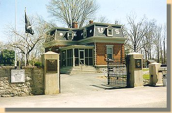
National Park Service Visitors Center for the Glendale
(Frayser's Farm) and Malvern Hill Battlefield parks.
The Visitors Center is located at the Glendale National Cemetery, almost
directly across the road from the Willis Church (see
Malvern Hill).
|
|
 >
Civil War Photos
>
Richmond - Outlying
> Glendale
>
Civil War Photos
>
Richmond - Outlying
> Glendale

|
|
