|
U. S. CIVIL WAR
PHOTOGRAPHS
|

|
BEAVER DAM CREEK
(PAGE 2 OF 2)
| |
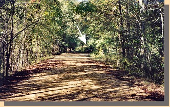
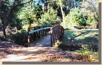
Restored Old Cold Harbor Road (left) and the N.P.S. foot bridge (right). The
N.P.S. foot bridge is near the location where the nineteenth century bridge
crossed Beaver Dam Creek. It's location is marked with an arrow on the left
photograph. (The photographs were taken along the Old Cold Harbor Road near
the location marked "B" on the map on the first page of this section).
|
|
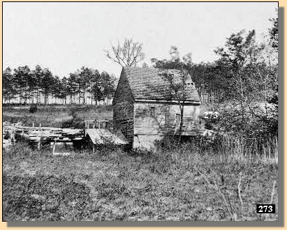
Ellerson's Mill (between 1861 and 1865)
|
|
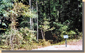
The left photograph shows the approximate site of Ellerson's Mill, just off of
the Old Cold Harbor Road.
(Some nineteenth century maps show the Mill on the other side of the
road.)
This location is marked "B" on the map on the first page of this section.
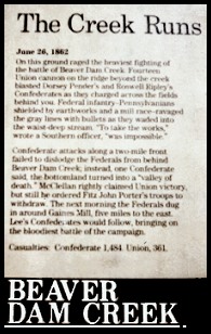
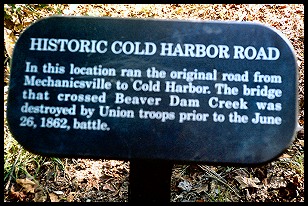
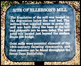
N.P.S. Sign at Beaver Dam
The Creek Runs
June 26, 1862
On this ground raged the heaviest fighting of
the battle of Beaver Dam Creek. Fourteen
Union cannon on the ridge beyond the creek
blasted Dorsey Pender's and Roswell Ripley's
Confederates as they charged across the fields
behind you. Federal infantry --- Pennsylvanians
shielded by earthworks and a mill race --- ravaged
the gray lines with bullets as they waded into
the waist-deep stream. "To take the works,"
wrote a Southern officer, "was impossible."
Confederate attacks along a two-mile front
failed to dislodge the Federals from behind
Beaver Dam Creek; instead, one Confederate
said, the bottomland turned into a "valley of
death." McClellan rightly claimed Union victory,
but still he ordered Fitz John Porter's troops to
withdraw. The next morning the Federals dug
in around Gaines' Mill, five miles to the east.
Lee's Confederates would follow, bringing on
the bloodiest battle of the campaign.
Casualties: Confederate 1,481. Union, 361.
|
|
BEAVER
DAM CREEK
|
 (B) (B)
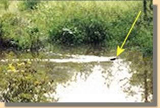
And what would you expect to find on the
historic Beaver Dam Creek battlefield?
How about a Beaver?
 >
Civil War Photos
>
Richmond - Outlying Area
>
Beaver Dam Creek
> Page 2
>
Civil War Photos
>
Richmond - Outlying Area
>
Beaver Dam Creek
> Page 2

Notes
|
|